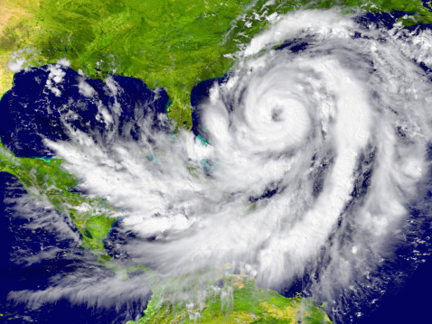
NOAA has revised its May prediction regarding the Atlantic hurricane season, saying that forecasters are now expecting a less intense season than originally anticipated. As we are entering what often proves to be the worst time of year for hurricanes in the Atlantic, that’s good news — but it doesn’t mean the danger is over!

NOAA’s Revised Predictions
As of early August, NOAA gave the following updated predictions regarding this year’s hurricane season for the Atlantic:
- 9 to 13 total named storms are predicted (winds 39 mph or greater)
- 4 to 7 of those storms are expected to become hurricanes (winds in excess of 73 mph)
- Of the hurricanes, up to 2 are expected to turn into major hurricanes (winds in excess of 110 mph)
Thus far, in the Atlantic, there have been only 5 named storms (Alberto, Beryl, Chris, Debby, and Ernesto). Two of those developed into hurricanes, but neither of them went on to develop into major hurricanes.
Based on NOAA’s current predictions, there will be between 4 and 8 more storms, of which 2 to 5 may turn into hurricanes. Of the hurricanes, there is a chance that none of them will turn into major hurricanes, but there still remains a threat of severe storms for the U.S. Keep in mind that this does not involve landfall predictions, which are more closely tied to short-term weather patterns.
Another aspect of their revised predictions involves the probability of whether or not this will prove to be a normal hurricane season. The current forecast is:
- A 10% chance that this will prove to be an above-normal season
- A 30% chance of a near normal season
- A 60% chance of a below normal season
The highest probability indicates that we can expect a below normal season, which is good news for all involved – especially those areas that were hit hard last year. This prediction is up from 25% probability of a below normal season from NOAA’s predictions back in May.
Why We’ve Had A Below Normal Season Thus Far
 We’ve reached what is considered peak hurricane season, and thus far the predictions have proven accurate. One of the measures of the lifetime and strength of storms is Accumulated Cyclone Energy. Thus far, the accumulated cyclone energy for the Atlantic is below average for this time of year. The hurricane season is remaining extremely mild, and meteorologists have attributed this to three key things: cooler temperatures, dry air, and El Niño.
The first reason for a below-normal season prediction is cooler than average temperatures, including those across the surface of the Atlantic Ocean and the Caribbean Sea. Temperatures have also been cooler between the Lesser Antilles and Africa. When disturbances exit Africa, they are met with cool air and a stable atmosphere that works to suppress them.
Air in certain regions of the Atlantic has been much drier than usual, making for an atmosphere that is inhospitable to the development of storms. Another major factor is El Nino. Right now, meteorologists are predicting a 60-70% likelihood El Niño will develop with enough strength to suppress further storms. El Niño is expected to produce enough wind shear to disrupt thunderstorm formation.
Thoughts as We Enter Peak Season
Hurricane season comes to an end on November 30, but we aren’t out of danger yet. Historically, most of the devastating hurricanes tend to occur between the last part of August and late September. That means the most dangerous time of hurricane season is already upon us, and the longer we go without a hurricane then the more likely it is that one will develop.
Right now, meteorologists are predicting multiple tropical waves in development along the western coast of Africa. This is known as the Main Development Region (MDR) for Atlantic hurricane and has a major impact on the development of Atlantic hurricanes. Weather forecasters are predicting an uptick in activity that will no doubt have an effect on the most active month of the Atlantic hurricane season — September. Historically, more hurricanes tend to form in the Atlantic during the month of September than any other month of the year.
Hurricane Katrina made landfall in New Orleans on August 29, 2005. Hurricane Harvey made landfall on August 25, 201,7 in South Texas. Hurricane Wilma made landfall in South Florida on October 24, 2005. That shows the range of dates that we can expect from landfalls of major hurricanes.

Conclusion
The Atlantic hurricane season has been quite mild this year, due in no small part to lower sea and ocean surface temperatures, dryer air, and the development of El Niño. While in all likelihood we won’t see the same level of hurricane-wrought devastation that we experienced last year, there remains a significant threat of hurricanes — especially with recent developments in the Atlantic hurricanes’ MDR. Keep in mind that these are only predictions, and that it only takes one severe hurricane to wreak havoc and destruction to an entire state. After a full year, people in Houston, Texas are still recovering from Hurricane Harvey. Stay alert to warnings, and don’t take the personal safety of you or your family for granted simply because this is expected to be a below normal hurricane season.
